by Ken Brusic
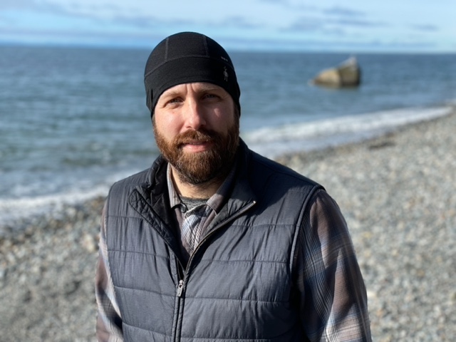
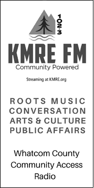
Whatcom Land Trust executive director Gabe Epperson at Point Whitehorn south of Blaine.
photo: Ken Brusic
Gabe Epperson has two offices: a vast landscape that stretches eastward from the shores of the Salish Sea to the foothills of the Cascades, and a small room in a downtown Bellingham office along the banks of Whatcom Creek.
At this moment, outside the window of his city workplace, an anxious woman is shouting, gesturing, shredding something and tossing the pieces that flutter into the brush bordering the creek.
This outside scene of distress contrasts with the methodical long-term planning that takes place inside. It is here that Epperson, the executive director of the Whatcom Land Trust, oversees another kind of dynamic tension: growth and development vs. the preservation of land, resources and quality of life.
“The why of the Land Trust is because of that tension,” Epperson said in a recent interview.
“The Land Trust was founded in the 80s, actually in Lynden,” he said. “The original board and founders included several Lynden farmers. They were seeing this rapid growth in the loss of farmland.
“The land trust emerged because of growth pressure and the loss of critical lands.”
The Trust has evolved to include potentially threatened land and watersheds throughout Whatcom County — areas that define the unique, natural qualities of this place.
“As we’re growing, we don’t want to lose what makes Whatcom County special,” he said.
To understand how the Land Trust undertakes this difficult task, you need to study the colorful map of the territory displayed on its website. The map, along with the accompanying text outlining five public priorities, is the result of a strategic planning process that stretched over most of a decade.
The green splotches on the map represent areas that the Trust either owns, partners with others, or protects through conservation easements — a formal, legal process that benefits land owners but protects the land from further development.
At first glance, the map looks like an abstract painter dipped a brush into green ink and flicked it over the map, leaving seemingly irregular and random green flecks.
Epperson said he studied the map before he interviewed for a job here.
“I’m just seeing a map with green splattered across it,” he said. “I couldn’t make any sense of it.”
That changed as he accepted his first job as conservation director and learned more about the Trust, its mission and the community.
Utah and Vermont, Then Washington
Gabe Epperson has always had an abiding interest in the land.
He grew up in Utah, then went to Middlebury College in Vermont, where he majored in environmental studies. Then back to Utah where he received his Master of Public Administration degree.
Almost all of his work experience has focused on the environment and its preservation. For two years, he owned and managed his own startup in Utah where he attempted to crowdsource conservation financing.
While he was in college, his dad left a teaching post at Brigham Young University and moved the family to Vancouver, B.C., to become a Unitarian minister.
Epperson visited, became enchanted with the Pacific Northwest and started looking for jobs so he could be closer to family.
“I just fell in love with the Northwest,” he said. “I always thought that if the opportunity came up, I’d love to move up here to be close to family and be in this environment.”
Those feelings grew stronger when he and wife, Elisabeth, had two children, Jane, now 10, and Peter, 8.
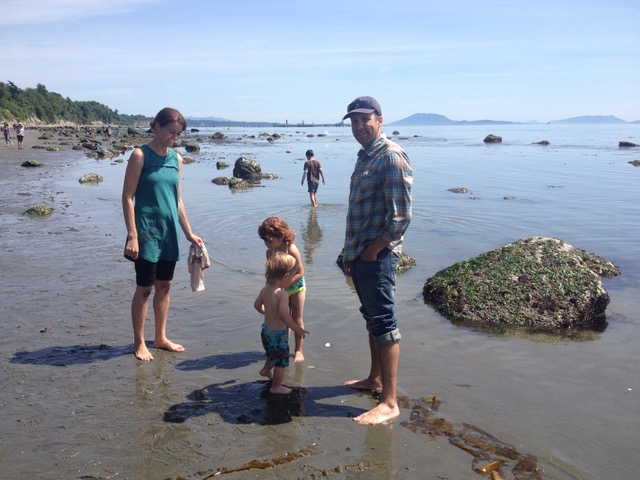
Gabe and Elisabeth Epperson explore the beach at Point Whitehorn at low tide with Jane and Peter when the children were younger.
photo courtesy Gabe Epperson
When the job of conservation director opened in June, 2015, Epperson joined the Trust. That’s when he understood what all those green marks were on the map, and set about methodically adding to them.
Five and a half years later, the executive director position opened up. After a nine-month nationwide search, the board chose Epperson.
Hall Walker, the current president of the Land Trust board of directors, says the organization made a wise choice. He credits Epperson, 41, with building strong bonds throughout the community.
“We’ve got very good relationships with a lot of our local government partners and with the state, a number of other conservation agencies that we partner with, and our tribal partners,” Walker said.
He describes Epperson as methodical, upfront, earnest — always moving toward collaboration and consensus.
His style is, “Let’s talk about it. Make sure that we are understanding what each other is saying. (That we’re) understanding the concerns and the positions of folks involved.
“I see him do that a lot. Everybody can come out ahead. I think that method of having those discussions is super, super effective.”
Part of the proof is in the numbers of protected land:
• 97-plus miles of marine, river and lake shorelines
• 11,536 acres in the Lake Whatcom watershed
• 13,977 acres of working agricultural lands
• 13,837 acres of parkland
Numbers are one thing, but to understand the concept of saving the land, you need to take a short hike. At the southern end of Fieldston Road in Bellingham’s Edgemoor neighborhood, are two green WELCOME signs. One marking the beginning of the west Clark viewpoint — the other a trail to the east.
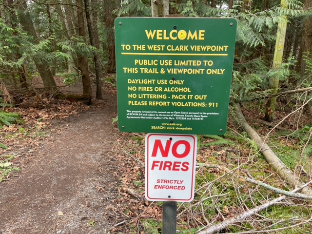
Clark’s Point trailhead in South Bellingham leading to sweeping view of the San Juan Islands. photo: Ken Brusic
Going west through a forest leads to an overlook displaying a majestic, panoramic view of some of the San Juan Islands. The second trail leads to a view overlooking the north end of Chuckanut Bay.
Instead of the trail, trees and overlooks that comprise the 71-acre property, 105 homes could be there, the number of houses in an original survey, said Bill Wright. He and his wife, Patrice, negotiated a conservation easement with the Land Trust.
Patrice is the daughter of Doug Clark, who originally owned the point, named Clark’s Point. As time passed, the Wrights wanted to insure the future of the land.
They turned to the Land Trust and worked with Rand Jack, an attorney and original Land Trust board member.
The easement allows for four homes on relatively small lots, Wright said, but protects the shoreline and forestland forever. Owners can modify their homes under certain restrictions, even sell them. But the new owners are legally bound by the easement restrictions.
Wright has sometimes struggled with issues that thoughtless users of the public trail have left behind — fires, trash, graffiti — but he’s a willing and enthusiastic steward of the land, content in knowing that the place will be open and undeveloped for the benefit of all those who come after him.
Army of Volunteers
Acquiring land through ownership or easements to protect watersheds, farmland and forests is essential to the Land Trust mission. But so is stewardship.
The Trust has amassed an army of volunteers to help. Many come with friends, family or business colleagues to participate in work parties or other activities.
One of them is Barney Barnhardt who has been volunteering since 2017. He has painted trim around windows, helped build a shed, served food and worked with the philanthropy committee.
“It’s a blast,” he said during a telephone conversation while out at Lake Padden with his Labrador retriever. “I love it. I have a heart for the land.”
He sees that same feeling in Epperson. “He is all about stewardship,” Barnhardt said. “Not just acquisition, but stewardship. I love that. That his heart is bent that way.”
The spine of the volunteer effort consists of volunteer land stewards. This battalion is made up of about 120 people who agree to visit an assigned Land Trust property at least once every three months and file a written report on its condition. It’s a serious commitment.
Janet Murray has been a land steward for 10 years. She’s retired and watches over the Kelsey property, an early 20-acre Trust acquisition west of Ferndale. A creek on the property drains into Lake Terrell.
She estimates that she visits the property about 150 times a year. She has written grants for it, planted trees, cleaned up trash and maintained the land. She also serves on the Trust’s stewardship committee.
“It’s just been a total learning experience,” she said. Everything I’ve done there, I’ve learned from. I’ve learned to teach. I’ve learned about what grows here. I’ve learned a lot about forestry.”
She credits Jennifer Mackey, the stewardship director, for her ongoing support.
“She’s super dynamic,” Murray said. “She is really, really good. She’s young, and she’s very organized.”
Mackey and nine others make up the paid staff of the Trust. Epperson has forged strong working relationships among them. Each is part of a team working toward land preservation. It’s no surprise that their website bios talk about their desire to be out enjoying and celebrating the beauty and promise of the land.
Climate Change and Connectivity
People have exacted a monumental toll over time as they have spread across the county. An estimated 97 percent of the old growth forests in an area that stretches from the Cascades to the Chuckanuts no longer exists.
Each year brings new challenges. An extraordinary heat dome last summer resulted in record high temperatures, withering fields and stressing forests and people. November rains caused more than $150 million in damage, according to Whatcom County officials. Increasingly, streams are too warm or slow during a summer drought. Salmon struggle and die. Covid-19 restricts our ability to come together as a community.
“It’s been a tough couple years,” Epperson said, struggling with his own feelings of a society plagued by political disunity, inequality and racial animosity.
One antidote is his decision to commit himself and the Trust to two priorities: climate change and connectivity.
He says he believes that many people have an apocalyptic and fatalistic view of the changing climate. They feel that at some point life on earth just ends.
He sees it more as a steadily, slowly unfolding series of problems. His answer is to use tools that mitigate the severity of the effects. Get people out of flood-prone areas. He wants to build buffers against the worst effects of climate change through targeted acquisitions, easements and planning in the areas that are threatened by flooding and coastal sea rise.
He wants to create more wetlands. “They’re like a sponge,” he said. “They slow things down. They absorb things.”
Then there’s the concept of community forests and changing forestry practices to increase carbon sequestration. He points to the 2,200-acre Canyon Lake Community Forest and the 2,229-acre Galbraith Tree Farm, as examples of collaboration among government, private owners, the Land Trust and nonprofits. Trees can be sensibly harvested, new ones planted, recreational opportunities opened up. Yet the land is forever protected from commercial or private development.
“We’re just one county,” he said. “But there’s an army of land trusts and conservationists in the United States and throughout the world. And we’re all working on similar goals of growing our forests, looking at farming practices that sequester carbon, protecting and restoring estuaries in places that are carbon sinks.
“So that’s what the Land Trust can do. You can spend your time just dreading the future and climate change and feeling hopeless, or you can support the work that land trusts are doing to protect land and then do restoration with our partners.”
The message boils down to one word: hope. Without it, possibilities and aspirations shrink. Positive momentum ceases.
Connectivity is the extension of that concept. It brings together ideas and people committed to using the tools to effect change. For themselves, their children, the community and the future in the way that Bill Wright and his wife have secured Clark’s Point.
Point Whitehorn and Stewart Mountain
We’re in Gabe Epperson’s other office now. The one that includes the fertile soils of the Nooksack River valleys. The one that gives life to the many avian, mammal and aquatic species. The one that provides recreational opportunities that cleanse the spirit and enhance quality of life. The one that provides food and clean water. The one that allows people close to the land to enjoy a livelihood while helping protect and sustain it.
He is at Point Whitehorn, a 54-acre natural area south of Blaine. The land was acquired by the Land Trust in 2007, and, with a conservation easement, transferred to Whatcom County for use as a park. A sign at the start of the 3/4-mile trail tells visitors that the reserve was made possible by a $1 million grant to the Trust from fines levied because of a 1999 Whatcom Creek gasoline pipe rupture and explosion that killed three people and caused widespread damage.
Epperson hikes the trail, crossing over boardwalks that protect the coastal wetland. He points out the Sitka spruces, a large coniferous evergreen that likes to hug the Washington coast and can grow to 300 feet, making them the largest species of spruce.
The trail offers bluff overlooks with sweeping views of the San Juan Islands, then a steep drop to the beach. Harbor seals often hang out to the north along the shore.
Looking out toward the sea, Epperson, standing at the edge of Whatcom County, talks about its future. Like many of us, he has concerns.
“What’s going to happen with climate change?” he asks. “Or what’s going to happen if the land becomes too expensive to live here and increases inequality.
“I’m more optimistic about our work and our objectives than I am about some of those larger things that seem out of our control.”
Projects like the Stewart Mountain Community Forest initiative excite him and offer that hope. In 2017, a New Hampshire timber management company acquired 6,000 acres at Stewart Mountain between Lake Whatcom and the South Fork Nooksack River Valley.
The company approached the Land Trust to see if it would have an interest in purchasing the land to develop a locally owned community forest that would balance a variety of ecological, economic and community benefits.
The plan would roll out in stages, if resources become available, the first being acquisition of forested terrain along the South Fork of the Nooksack River, an opportunity to provide a buffer as well as protecting and restoring salmon habitat.
Epperson wants to use opportunities like Stewart Mountain to change the existing model.
“I’m working on the county and society to manage our ecosystems differently, in a way that’s sustainable,” he said. “That supports biodiversity and ecosystem health and provides an alternative to industrial farming and industrial forestry.”
It’s something important that he thinks he can do. Feels compelled to do.
So, on this sunny, mild February day, Gabe Epperson takes one last look at the ocean and the land surrounding one of his favorite places, climbs the trail up the 80-foot bluff and heads back to work.
For additional information about the Whatcom Land Trust: www.whatcomlandtrust.org.
__________________________
Ken Brusic is the former longtime editor of The Orange County Register, a Pulitzer-prize winning daily newspaper that serves 34 Southern California communities with a total population of 3.3 million. He also holds a USCG 100-ton near coastal captain’s license.